2019
SY9675 : Interior of St Aldhelm's Chapel
taken 5 years ago, near to Worth Matravers, Dorset, England
This is 1 of 2 images, with title Interior of St Aldhelm's Chapel in this square
Interior of St Aldhelm's Chapel
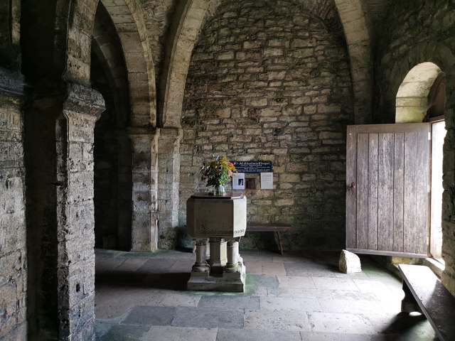
St Aldhelm's Chapel is a Norman chapel on St Aldhelm's Head near Worth Matravers, Dorset. It is a Grade I listed building.
The square stone chapel stands within a low circular earthwork, which may be the remains of a pre-Conquest Christian enclosure. The building has several architectural features which are unusual for a chapel; the square shape, the orientation of the corners of the building towards the cardinal points, and the division and restriction of the interior space by a large central column. The lack of evidence for an altar or a piscina suggests that the building may not have been built as a chapel. It may have originally been built as a watchtower for Corfe Castle, covering the sea approaches to the south.
The interior of the chapel is approximately 25 feet square. In the centre is a square pier supporting four square rib vaults, with the heavy ribs leading to transverse arches, all stop-chamfered. In the north-west side is a Norman round-arched doorway. A small window is contemporary with the doorway.
During the late 19th and early 20th centuries regular weekly services were held, attended by coastguards and their families who lived in nearby cottages.
See other images of St Aldhelm's Chapel
 Map © Crown Copyright")
TIP: Click the map for more Large scale mapping
- Grid Square
- SY9675, 138 images (more nearby 🔍)
- Photographer
- Phil Champion (more nearby)
- Date Taken
- Thursday, 5 September, 2019 (more nearby)
- Submitted
- Saturday, 4 January, 2020
- Subject Location
-
OSGB36:
 SY 9606 7555 [10m precision]
WGS84: 50:34.7805N 2:3.4204W - Camera Location
-
OSGB36: SY 9607 7556
- View Direction
- Southwest (about 225 degrees)