H5070 : Derelict bridge over the Camowen River
taken 4 years ago, 5 km ESE of Omagh, Co Tyrone, Northern Ireland
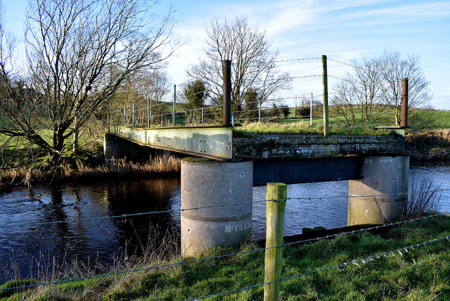
Derelict bridge over the Camowen River
It spans across from Donaghanie to Lisnahoppin
Once used to access farmland for grazing cattle
Once used to access farmland for grazing cattle
![Creative Commons Licence [Some Rights Reserved]](https://s1.geograph.org.uk/img/somerights20.gif)
|
· Find out How to reuse this image ·
Share:
|
|||||
| Start a discussion on H5070 | Suggest an update to this image | Contact the contributor | |||
Loading map... (JavaScript required)
- Grid Square
- H5070, 272 images (more nearby
 )
)
- Photographer
- Kenneth Allen (find more nearby)
- Date Taken
- Thursday, 9 January, 2020 (more nearby)
- Submitted
- Friday, 10 January, 2020
- Geographical Context
- Subject Location
-
Irish:
 H 500 702 [100m precision]
WGS84: 54:34.6995N 7:13.5871W - Camera Location
-
Irish: H 501 702
- View Direction
- WEST (about 270 degrees)
Other Tags
This page has been viewed about 42 times.
View this location:
KML (Google Earth) ·
Google Maps ·
Bing Maps ·
Geograph Coverage Map ·
More Links for this image
·
Bing Maps ·
Geograph Coverage Map ·
More Links for this image