2016
SZ6086 : Congregational Church
taken 8 years ago, near to Brading, Isle of Wight, England
Congregational Church
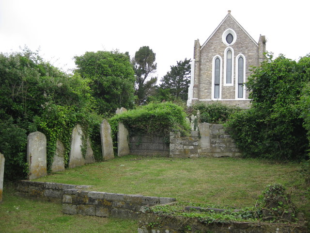
The churchyard at the rear of the ex-Congregational Church in The Mall. Built in 1846 it occupies a prominent position at the bottom of Bullys Hill. It closed on March 31st 1989 and is now a private home.
 Map © Crown Copyright")
TIP: Click the map for more Large scale mapping
- Grid Square
- SZ6086, 107 images (more nearby 🔍)
- Photographer
- Andrew Culley (more nearby)
- Date Taken
- Friday, 1 July, 2016 (more nearby)
- Submitted
- Tuesday, 14 January, 2020
- Subject Location
-
OSGB36:
 SZ 6049 8656 [10m precision]
WGS84: 50:40.5341N 1:8.7170W - Camera Location
-
OSGB36: SZ 6054 8655
- View Direction
- West-northwest (about 292 degrees)