2020
NZ5001 : Gold Hill, Faceby Bank and Whorl Hill
taken 4 years ago, near to Faceby, North Yorkshire, England
Gold Hill, Faceby Bank and Whorl Hill
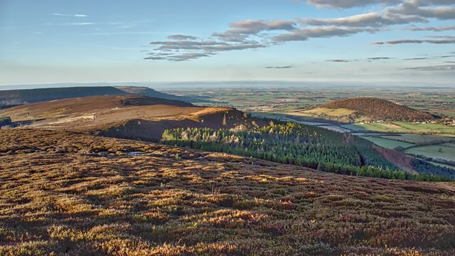
A beautiful morning for a run along the escarpment to Knolls End and back via Thackdale. Surveying from left to right. Live Moor, peppered with Bronze Age features, barrows and field systems, was in the 19th-century common grazing for the villagers of Swainby who kept their donkeys used to carry coal and other goods. That is grazing for the donkeys, not the villagers!
The slight rise of Gold Hill, catching the morning sun, is centre with its ruined summerhouse now buried in the heather. Whorl Hill is far left, a name that derives from the Old Norse hvirfill meaning, unimaginatively, a high hill with a rounded top.
In 1810 large and valuable hoard of Roman silver coins in a large silver vase was discovered while ploughing a field at the base of Whorl Hill. The coins date from Constantius to Honorius (AD 337-423). Similar hoards have been found near Wilton Castle below Eston Nab and Northallerton indicating deliberate concealment in troubled times possibly during the migrations of Saxons after the Romans abandoned in the 5th-century.
From my photo-diary for 21st January 2020 see Link
 Map © Crown Copyright")
TIP: Click the map for more Large scale mapping
- Grid Square
- NZ5001, 32 images (more nearby 🔍)
- Photographer
- Mick Garratt (more nearby)
- Date Taken
- Tuesday, 21 January, 2020 (more nearby)
- Submitted
- Tuesday, 21 January, 2020
- Subject Location
-
OSGB36:
 NZ 5096 0165 [10m precision]
WGS84: 54:24.4658N 1:12.9841W - Camera Location
-
OSGB36: NZ 5144 0166
- View Direction
- WEST (about 270 degrees)