2019
NY9539 : The lower Rookhope valley below Shepherd's House
taken 4 years ago, near to Eastgate, County Durham, England
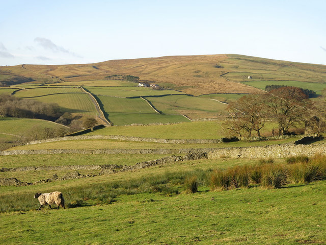
The lower Rookhope valley below Shepherd's House
Looking WNW across the valley from near NY9539 : Shepherd's House towards Low Northgate; to its left and slightly above is NY9340 : High Northgate. The isolated building on the far hillside (half right) is NY9340 : High Bishopseat.
 Map © Crown Copyright")
TIP: Click the map for more Large scale mapping
- Grid Square
- NY9539, 113 images (more nearby 🔍)
- Photographer
- Mike Quinn (more nearby)
- Date Taken
- Monday, 9 December, 2019 (more nearby)
- Submitted
- Wednesday, 22 January, 2020
- Subject Location
-
OSGB36:
 NY 9511 3993 [10m precision]
WGS84: 54:45.2576N 2:4.6500W - Camera Location
-
OSGB36: NY 9551 3984
- View Direction
- West-northwest (about 292 degrees)