2020
SX7480 : On Hayne Down
taken 4 years ago, near to Manaton, Devon, England
This is 1 of 5 images, with title On Hayne Down in this square
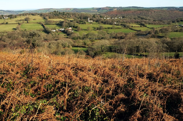
On Hayne Down
Another fine view towards St Winifred's church at Manaton across the access land of Hayne Down and the fields and woods of the Hayne Brook valley. Left of centre is Wingstone Farm.
 Map © Crown Copyright")
TIP: Click the map for more Large scale mapping
- Grid Square
- SX7480, 112 images (more nearby 🔍)
- Photographer
- Derek Harper (more nearby)
- Date Taken
- Monday, 20 January, 2020 (more nearby)
- Submitted
- Saturday, 25 January, 2020
- Subject Location
-
OSGB36:
 SX 744 804 [100m precision]
WGS84: 50:36.5853N 3:46.5878W - Camera Location
-
OSGB36: SX 7438 8036
- View Direction
- Northeast (about 45 degrees)