2020
TQ7655 : Land at Brunswick Street
taken 4 years ago, near to Maidstone, Kent, England
This is 1 of 2 images, with title Land at Brunswick Street in this square
Land at Brunswick Street
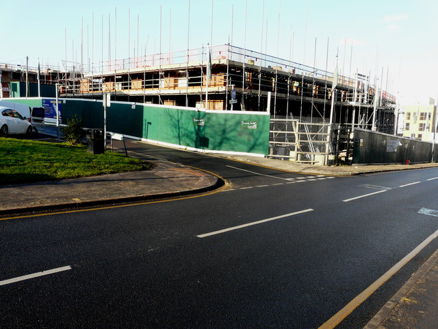
Planning permission was granted by Maidstone Borough Council under application number 17/504632/FULL for the proposed demolition of all existing buildings and introduction of a new 33 space public car park, together with 24 flats in a four storey block fronting Upper Stone Street. A row of 6 houses constructed over 3 storeys fronting Orchard Street. 2 rows of 4 houses each constructed over 3 storeys fronting Brunswick Street, and George Street and 9 flats in a stepped block overlooking the new pay and display car park. The development will include allocated parking and soft landscaping.
The view shows the building, under construction, on the corner of George Street and Upper Stone Street.
The view shows the building, under construction, on the corner of George Street and Upper Stone Street.
 Map © Crown Copyright")
TIP: Click the map for more Large scale mapping
- Grid Square
- TQ7655, 487 images (more nearby 🔍)
- Photographer
- John Baker (more nearby)
- Date Taken
- Tuesday, 21 January, 2020 (more nearby)
- Submitted
- Wednesday, 5 February, 2020
- Subject Location
-
OSGB36:
 TQ 7630 5521 [10m precision]
WGS84: 51:16.1264N 0:31.5499E - Camera Location
-
OSGB36: TQ 7634 5519
- View Direction
- West-northwest (about 292 degrees)