2020
NT2560 : Former railway route near Rosslynlee
taken 4 years ago, near to Auchendinny, Midlothian, Scotland
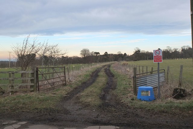
Former railway route near Rosslynlee
The former railway from Dalkeith to Leadburn, Peebles and Galashiels. For a few hundred metres it is in use for field access by tractors, thereafter as a partly overgrown track but still usable as a path to Rosslynlee.
 Map © Crown Copyright")
TIP: Click the map for more Large scale mapping
- Grid Square
- NT2560, 10 images (more nearby 🔍)
- Photographer
- Jim Barton (more nearby)
- Date Taken
- Friday, 7 February, 2020 (more nearby)
- Submitted
- Sunday, 9 February, 2020
- Subject Location
-
OSGB36:
 NT 2597 6067 [10m precision]
WGS84: 55:50.0135N 3:11.0090W - Camera Location
-
OSGB36: NT 2587 6061
- View Direction
- East-northeast (about 67 degrees)