J3731 : Flooded path in Islands Park, Newcastle
taken 4 years ago, near to Newcastle, Co Down, Northern Ireland
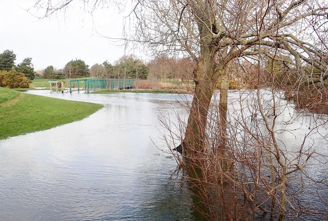
Flooded path in Islands Park, Newcastle
Heavy and intense rainfall associated with Storm Cara, combined with a Spring Tide, caused the Tullybranigan River to overflow its banks.
![Creative Commons Licence [Some Rights Reserved]](https://s1.geograph.org.uk/img/somerights20.gif)
|
· Find out How to reuse this image ·
Share:
|
|||||
| Start a discussion on J3731 | Suggest an update to this image | Contact the contributor | |||
Loading map... (JavaScript required)
- Grid Square
- J3731, 1847 images (more nearby
 )
)
- Photographer
- Eric Jones (find more nearby)
- Date Taken
- Sunday, 9 February, 2020 (more nearby)
- Submitted
- Tuesday, 11 February, 2020
- Geographical Context
- Subject Location
-
Irish:
 J 374 311 [100m precision]
WGS84: 54:12.6626N 5:53.6279W - Camera Location
-
Irish: J 374 311
- View Direction
- North-northwest (about 337 degrees)
This page has been viewed about 28 times.
View this location:
KML (Google Earth) ·
Google Maps ·
Bing Maps ·
Geograph Coverage Map ·
More Links for this image
·
Bing Maps ·
Geograph Coverage Map ·
More Links for this image