2020
NY9841 : Hill road descending to Hope House
taken 4 years ago, near to Crawleyside, County Durham, England
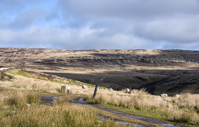
Hill road descending to Hope House
Hope House is a remote building on the west side of Stanhope Burn; it was deserted for some time. When reoccupied it's believed to have seen use as some sort of animal sanctuary; that's probably not so now, in 2020.
The erect stone with the nameplate 'Hope House' doesn't refer to the house itself but is an estate reference to a grouse shooting area, probably along the line of the hill track partly seen at the left side of the image.
The erect stone with the nameplate 'Hope House' doesn't refer to the house itself but is an estate reference to a grouse shooting area, probably along the line of the hill track partly seen at the left side of the image.
 Map © Crown Copyright")
TIP: Click the map for more Large scale mapping
- Grid Square
- NY9841, 85 images (more nearby 🔍)
- Photographer
- Trevor Littlewood (more nearby)
- Date Taken
- Wednesday, 26 February, 2020 (more nearby)
- Submitted
- Wednesday, 26 February, 2020
- Subject Location
-
OSGB36:
 NY 9818 4196 [10m precision]
WGS84: 54:46.3534N 2:1.7888W - Camera Location
-
OSGB36: NY 9814 4193
- View Direction
- Northeast (about 45 degrees)