J3729 : Donard Forest, Newcastle (4)
taken 16 years ago, 3 km from Newcastle, Co Down, Northern Ireland
Donard Forest, Newcastle (4)
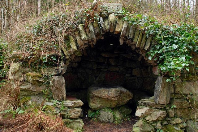
See J3730 : Donard Forest, Newcastle (3). Just after passing into this square the path passes this old shelter. Before the planting of the commercial forest it would have had excellent views over Newcastle towards Murlough and Dundrum. Continue to J3729 : Donard Forest, Newcastle (5).
![Creative Commons Licence [Some Rights Reserved]](https://s1.geograph.org.uk/img/somerights20.gif)
|
· Find out How to reuse this image ·
Share:
|
|||||
| Start a discussion on J3729 | Suggest an update to this image | Contact the contributor | |||
Loading map... (JavaScript required)
- Grid Square
- J3729, 438 images (more nearby
 )
)
- Photographer
- Albert Bridge (find more nearby)
- Date Taken
- Wednesday, 26 December, 2007 (more nearby)
- Submitted
- Wednesday, 26 December, 2007
- Category
- Shelter (more nearby)
- Subject Location
-
Irish:
 J 371 299 [100m precision]
WGS84: 54:11.9940N 5:53.9285W - Camera Location
-
Irish: J 372 299
- View Direction
- WEST (about 270 degrees)
Image classification(about):
Supplemental image
This page has been viewed about 73 times.
View this location:
KML (Google Earth) ·
Google Maps ·
Bing Maps ·
Geograph Coverage Map ·
More Links for this image
·
Bing Maps ·
Geograph Coverage Map ·
More Links for this image