2020
NZ3671 : National Cycle Route 1 Victoria Crescent, Cullercoats
taken 4 years ago, near to Cullercoats, North Tyneside, England
National Cycle Route 1 Victoria Crescent, Cullercoats
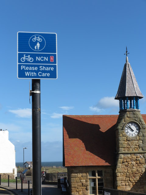
National Cycle Route 1 is part of the National Cycle Network, and is a 2,769 km-long cycle-path running from Dover to Shetland. As it passes through North Tyneside it hugs, as best it can, the North Sea coastline. At this point, it is also part of the England Coast Path which, when fully completed, will be the longest waymarked and managed coastal path in the world. In the background is the 1879-opened Watch House see Link for further details. For a selection of detailed free to download walking routes in the area visit Link
 Map © Crown Copyright")
TIP: Click the map for more Large scale mapping
- Grid Square
- NZ3671, 264 images (more nearby 🔍)
- Photographer
- Geoff Holland (more nearby)
- Date Taken
- Thursday, 12 March, 2020 (more nearby)
- Submitted
- Friday, 13 March, 2020
- Subject Location
-
OSGB36:
 NZ 3639 7139 [10m precision]
WGS84: 55:2.1422N 1:25.9301W - Camera Location
-
OSGB36: NZ 3635 7137
- View Direction
- Northeast (about 45 degrees)