2020
NZ3373 : Flooded Field adjacent to dismantled Avenue Branch Railway Line
taken 4 years ago, near to Earsdon, North Tyneside, England
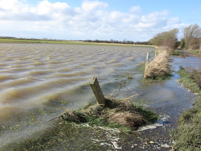
Flooded Field adjacent to dismantled Avenue Branch Railway Line
After heavy rain the night before, the already saturated field flooded beyond its boundaries cutting off the route of the public bridleway along the course of the dismantled Avenue Branch Railway Line (visible in the top right corner of the photograph). It was a case of 'flood on the tracks' (with apologies to Bob Dylan see Link (Archive Link ) . For a selection of detailed free to download walking routes in the area visit Link
 Map © Crown Copyright")
TIP: Click the map for more Large scale mapping
- Grid Square
- NZ3373, 27 images (more nearby 🔍)
- Photographer
- Geoff Holland (more nearby)
- Date Taken
- Thursday, 12 March, 2020 (more nearby)
- Submitted
- Saturday, 14 March, 2020
- Subject Location
-
OSGB36:
 NZ 3365 7361 [10m precision]
WGS84: 55:3.3507N 1:28.4866W - Camera Location
-
OSGB36: NZ 3370 7359
- View Direction
- West-northwest (about 292 degrees)