2020
TM2632 : Harwich: Church of St Nicholas
taken 4 years ago, near to Harwich, Essex, England
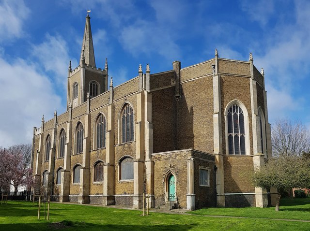
Harwich: Church of St Nicholas
The Church was built around 1820 and consecrated in 1822. It is a Grade II* Listed Building.
The spire was a 3rd Order Ordnance Survey intersected Triangulation Station. For those who need to know such things, its published OSGB36 National Grid co-ordinates were Easting 626104.063, Northing 232575.781!
The spire was a 3rd Order Ordnance Survey intersected Triangulation Station. For those who need to know such things, its published OSGB36 National Grid co-ordinates were Easting 626104.063, Northing 232575.781!
 Map © Crown Copyright")
TIP: Click the map for more Large scale mapping
- Grid Square
- TM2632, 244 images (more nearby 🔍)
- Photographer
- Nigel Cox (more nearby)
- Date Taken
- Sunday, 15 March, 2020 (more nearby)
- Submitted
- Sunday, 22 March, 2020
- Subject Location
-
OSGB36:
 TM 2611 3258 [10m precision]
WGS84: 51:56.7442N 1:17.3153E - Camera Location
-
OSGB36: TM 2615 3256
- View Direction
- West-northwest (about 292 degrees)