2020
TF0924 : Morton: aerial 2020 (2) and some circular parch marks: aerial 2020
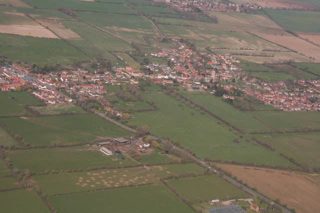
taken 4 years ago, near to Morton, Lincolnshire, England
Morton: aerial 2020 (2) and some circular parch marks: aerial 2020
Probably bare patches where the stock has been fed.
Ridge and furrow on east side of the road.
See also TF0923 : Parch markes in field at Bunkers Hill Farm, south of Morton: aerial 2020.
Ridge and furrow on east side of the road.
See also TF0923 : Parch markes in field at Bunkers Hill Farm, south of Morton: aerial 2020.
 Map © Crown Copyright")
TIP: Click the map for more Large scale mapping
- Grid Square
- TF0924, 77 images (more nearby 🔍)
- Photographer
- Chris (more nearby)
- Date Taken
- Sunday, 22 March, 2020 (more nearby)
- Submitted
- Tuesday, 24 March, 2020
- Subject Location
-
OSGB36:
 TF 0984 2408 [10m precision]
WGS84: 52:48.1861N 0:22.3276W - Camera Location
-
OSGB36: TF 0874 2253
- View Direction
- Northeast (about 45 degrees)