2020
SE0897 : Lower Swaledale from Ellerton Scar
taken 4 years ago, near to Marrick, North Yorkshire, England
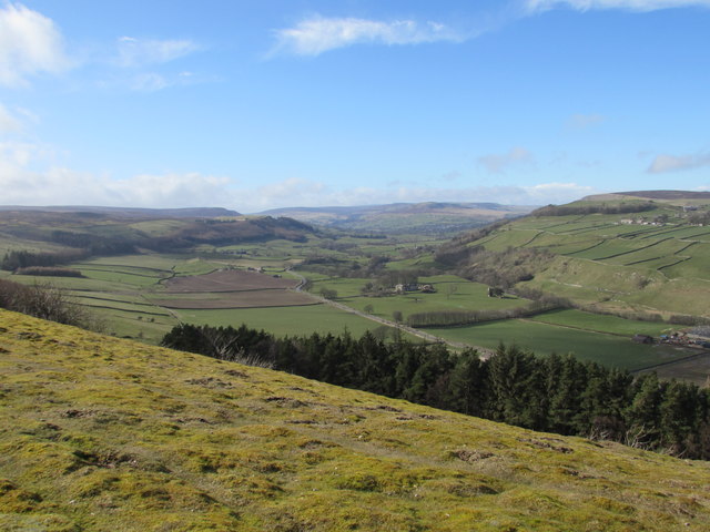
Lower Swaledale from Ellerton Scar
A line of trees separates Swale Farm & Ellerton Priory Farm in the valley below.
Two fields on the south side of the road have been ploughed, a practice that happens rarely beyond this point in the dale, as it's mostly permanent pasture for sheep & some cattle.
Two fields on the south side of the road have been ploughed, a practice that happens rarely beyond this point in the dale, as it's mostly permanent pasture for sheep & some cattle.
 Map © Crown Copyright")
TIP: Click the map for more Large scale mapping
- Grid Square
- SE0897, 8 images (more nearby 🔍)
- Photographer
- Matthew Hatton (more nearby)
- Date Taken
- Sunday, 15 March, 2020 (more nearby)
- Submitted
- Thursday, 26 March, 2020
- Subject Location
-
OSGB36:
 SE 081 972 [100m precision]
WGS84: 54:22.2580N 1:52.5450W - Camera Location
-
OSGB36: SE 089 970
- View Direction
- West-northwest (about 292 degrees)