2020
TF1928 : Rigbolt House: aerial 2020 (1)
taken 4 years ago, near to Gosberton Clough, Lincolnshire, England
Rigbolt House: aerial 2020 (1)
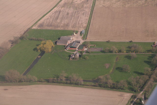
Includes a moated site incorporating two enclosures on a line north-south
and, adjoining this, to the north and east of the northern enclosure, the
remains of part of a field system of medieval type. Rigbolt House is
identified as the site of a cell of Sempringham Priory.
See Link
and, adjoining this, to the north and east of the northern enclosure, the
remains of part of a field system of medieval type. Rigbolt House is
identified as the site of a cell of Sempringham Priory.
See Link
 Map © Crown Copyright")
TIP: Click the map for more Large scale mapping
- Grid Square
- TF1928, 13 images (more nearby 🔍)
- Photographer
- Simon Tomson (more nearby)
- Contributed by
- Chris (more nearby)
- Date Taken
- Sunday, 22 March, 2020 (more nearby)
- Submitted
- Saturday, 28 March, 2020
- Subject Location
-
OSGB36:
 TF 1941 2820 [10m precision]
WGS84: 52:50.2853N 0:13.7241W - Camera Location
-
OSGB36: TF 1856 2786
- View Direction
- East-northeast (about 67 degrees)