2020
SH7780 : Breakwater and dunes
taken 4 years ago, near to Deganwy, Conwy, Wales
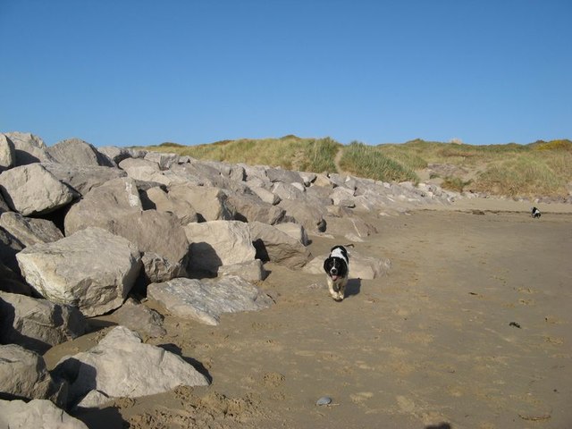
Breakwater and dunes
The breakwater at Cerrig Duon comprises massive blocks of limestone and functions superbly at its allotted task of catching sand which would otherwise continue its northerly drift and bury the West Shore promenade completely. The council appears at last to have abandoned any attempt to keep clear the coastal cycleway north from here in favour of an alternative alongside the A546 road to Maesdu Bridge.
 Map © Crown Copyright")
TIP: Click the map for more Large scale mapping
- Grid Square
- SH7780, 105 images (more nearby 🔍)
- Photographer
- Jonathan Wilkins (more nearby)
- Date Taken
- Monday, 6 April, 2020 (more nearby)
- Submitted
- Saturday, 11 April, 2020
- Subject Location
-
OSGB36:
 SH 7723 8065 [10m precision]
WGS84: 53:18.5110N 3:50.6420W - Camera Location
-
OSGB36: SH 7718 8062
- View Direction
- East-northeast (about 67 degrees)