2020
TL1607 : 116 Clarence Road
taken 4 years ago, near to St Albans, Hertfordshire, England
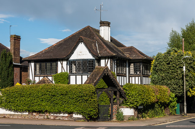
116 Clarence Road
House at the corner of Clarence Road and Jennings Road, in an area that started development in the late 19th Century of fields previously belonging to St Peters Farm, part of the larger Earl Spencer Estate. However, this particular plot appears to have remained empty until around the 1930s. Locally listed.
 Map © Crown Copyright")
TIP: Click the map for more Large scale mapping
- Grid Square
- TL1607, 83 images (more nearby 🔍)
- Photographer
- Ian Capper (more nearby)
- Date Taken
- Friday, 1 May, 2020 (more nearby)
- Submitted
- Tuesday, 5 May, 2020
- Subject Location
-
OSGB36:
 TL 160 077 [100m precision]
WGS84: 51:45.4124N 0:19.2373W - Camera Location
-
OSGB36: TL 159 077
- View Direction
- East-northeast (about 67 degrees)