2020
SK0306 : Steps to former Midland Railway trackbed and path
taken 4 years ago, near to Clayhanger, Walsall, England
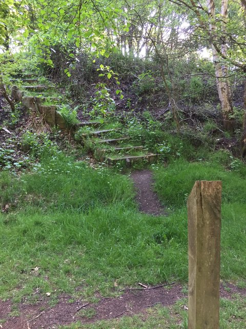
Steps to former Midland Railway trackbed and path
Signposted (not maintained) steps up onto former Midland Railway elevated section, between A452 Chester Road North and Coppice Lane (Brownhills). Leafy paths and trails nearby.
 Map © Crown Copyright")
TIP: Click the map for more Large scale mapping
- Grid Square
- SK0306, 45 images (more nearby 🔍)
- Photographer
- Michael Westley (more nearby)
- Date Taken
- Saturday, 9 May, 2020 (more nearby)
- Submitted
- Sunday, 10 May, 2020
- Subject Location
-
OSGB36:
 SK 0391 0612 [10m precision]
WGS84: 52:39.1678N 1:56.6182W - Camera Location
-
OSGB36: SK 0390 0611
- View Direction
- East-northeast (about 67 degrees)