J5284 : The 'BG Diamond' off Groomsport
taken 4 years ago, near to Groomsport, Co Down, Northern Ireland
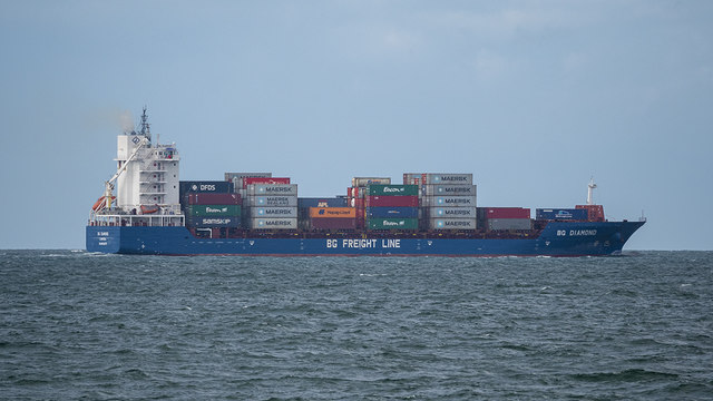
The idea and creation of the modern shipping container can be credited to American businessman (and former trucking company owner) Malcolm McLean in 1955. Rather than wait days for ships to be loaded and unloaded he devised a simple system where goods could be packed into standardised, rugged containers - these could then be carried by road or rail but also loaded, locked and stacked securely on board ships for transport across the globe and easily unloaded at the other end. The system revolutionised modern transportation of goods, increasing efficiency, lowering costs but also costing thousands of jobs across ports around the world. Today around 90% of non-bulk cargo is carried via shipping containers. In the UK, enormous ships that can carry over 14,000 containers arrive into ports such as Felixstowe and Harwich or nearby Rotterdam. Containers are then unloaded and moved across the country by road, rail or onto smaller 'feeder' ships that can navigate other ports around the country. To understand more about the process see the BBC Box project at Link
which tracked the route of a shipping container across the globe or the excellent programme 'The Box that Changed Britain' - frequently repeated on BBC4 and thus available on the iPlayer at Link
![Creative Commons Licence [Some Rights Reserved]](https://s1.geograph.org.uk/img/somerights20.gif)
|
· Find out How to reuse this image ·
Share:
|
|||||
| Start a discussion on J5284 | Suggest an update to this image | Contact the contributor | |||
- Grid Square
- J5284, 5 images (more nearby
 )
)
- Photographer
- Rossographer (find more nearby)
- Date Taken
- Tuesday, 12 May, 2020 (more nearby)
- Submitted
- Wednesday, 13 May, 2020
- Geographical Context
- Primary Subject of Photo
- Subject Location
-
Irish:
 J 520 849 [100m precision]
WGS84: 54:41.4004N 5:38.5654W - Camera Location
-
Irish: J 528 838
- View Direction
- Northwest (about 315 degrees)
Other Tags