2020
SE0959 : The Great Shack
taken 4 years ago, 4 km E of Appletreewick, North Yorkshire, England
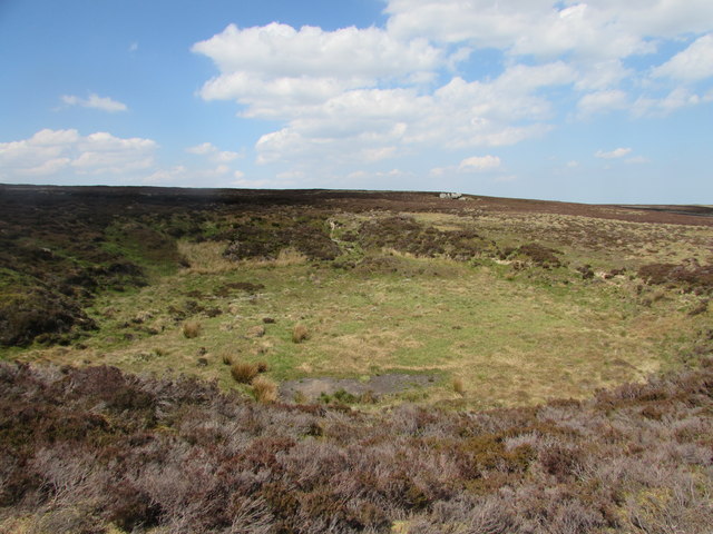
The Great Shack
A very large shake hole on Barden Fell where streams that form near Lord's Seat and Hen Stones are captured, and vanish underground.
 Map © Crown Copyright")
TIP: Click the map for more Large scale mapping
- Grid Square
- SE0959, 6 images (more nearby 🔍)
- Photographer
- Matthew Hatton (more nearby)
- Date Taken
- Wednesday, 20 May, 2020 (more nearby)
- Submitted
- Friday, 22 May, 2020
- Subject Location
-
OSGB36:
 SE 0901 5982 [10m precision]
WGS84: 54:2.0572N 1:51.8357W - Camera Location
-
OSGB36: SE 0903 5980
- View Direction
- Northwest (about 315 degrees)