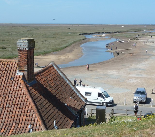
TG0244 : Blakeney - View from Mariner's Hill
taken 4 years ago, near to Blakeney, Norfolk, England
An English Heritage run attraction, it is open for free at reasonable times.
The building has always traditionally been called the Guildhall but nothing is known of its early history. It is likely to have originally been built for a prosperous medieval Blakeney fish merchant, the undercroft being used for storage of his merchandise. The building later became the guildhall of Blakeneys guild of fish merchants. The Guildhall was once a two-storey building but now all that remains is the 14th-century brick-vaulted undercroft. It is divided into two aisles by a row of stone piers which support the ribbed vaults of brickwork. The doorway and the windows are all original. The bricks, no doubt, were locally made and are typical of their period, being of variable shape, quality and appearance. For this reason brickwork of this period was often plastered over. The main building was entered from higher ground on the southern land side of the building. A projection at the south-east corner contains the shute that served a garderobe or privy.
It is believed that the Guildhall was once owned by the Carmelite Friary that stood nearby. It has been in the ownership of the village for over 400 years. There is a series of deeds recording the transfer of ownership from one group of trustees to the next. Each deed provides for the Guildhall to be used for the benefit of the villagers of Blakeney. The first surviving deed dates from 1627. There are other similar deeds dated 1687, 1750 and 1808. Subsequent deeds do not appear to have survived. Over the years the basement has been used for the storage of cargo, as a grain store, coal bunker, for growing mushrooms and also a worm and bait store for local fishermen. During the war years the basement was used as a mortuary for drowned sailors.
Blakeney is a coastal village in Norfolk. Blakeney lies within the Norfolk Coast AONB (Area of Outstanding Natural Beauty) and the North Norfolk Heritage Coast. The North Norfolk Coastal Path travels along its quayside.
Blakeney was a commercial port until the channel silted up, it is now a popular tourist location, with many historical and listed buildings.
Wikipedia: Link
 Map © Crown Copyright")
- Grid Square
- TG0244, 530 images (more nearby 🔍)
- Photographer
- Rob Farrow (more nearby)
- Date Taken
- Monday, 25 May, 2020 (more nearby)
- Submitted
- Saturday, 30 May, 2020
- Subject Location
-
OSGB36:
 TG 0269 4437 [10m precision]
WGS84: 52:57.5031N 1:0.9716E - Camera Location
-
OSGB36: TG 0285 4408
- View Direction
- North-northwest (about 337 degrees)