2019
TQ6141 : Tunbridge Wells Hospital
taken 5 years ago, near to Pembury, Kent, England
This is 1 of 6 images, with title Tunbridge Wells Hospital in this square
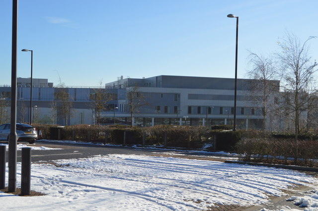
Tunbridge Wells Hospital
Pembury Hospital was a hospital near Pembury, Kent, England, run by the Maidstone and Tunbridge Wells NHS Trust. The hospital is located north-west of the village on Tonbridge Road.
The site was first developed in 1836 by the Tonbridge Poor Law Union as a workhouse, becoming a hospital in 1938.
The hospital closed and was demolished, except for a Grade II listed chapel, in 2010/11 and replaced by The Tunbridge Wells Hospital.
The Tunbridge Wells Hospital is a large district general hospital near Tunbridge Wells, run by the Maidstone and Tunbridge Wells NHS Trust. The hospital is located north-west of the village of Pembury on Tonbridge Road.
The hospital was built by Laing O'Rourke on the site of Pembury Hospital at a cost of £226 million. Building work started in 2008. The first phase of the new hospital opened in January 2011, the rest of the hospital opened on the 21st September 2011, all services were transferred from the Kent and Sussex Hospital.
See other images of Tunbridge Wells Hospital (Pembury Hospital)
 Map © Crown Copyright")
TIP: Click the map for more Large scale mapping
- Grid Square
- TQ6141, 185 images (more nearby 🔍)
- Photographer
- N Chadwick (more nearby)
- Date Taken
- Sunday, 3 February, 2019 (more nearby)
- Submitted
- Saturday, 30 May, 2020
- Subject Location
-
OSGB36:
 TQ 6154 4136 [10m precision]
WGS84: 51:8.9225N 0:18.4927E - Camera Location
-
OSGB36: TQ 6141 4138
- View Direction
- EAST (about 90 degrees)