2006
SH6254 : Incline built to serve now abandoned nearby workings with the Britannia Crushing Mill
taken 18 years ago, 4 km N of Plas Gwynant, Gwynedd, Wales
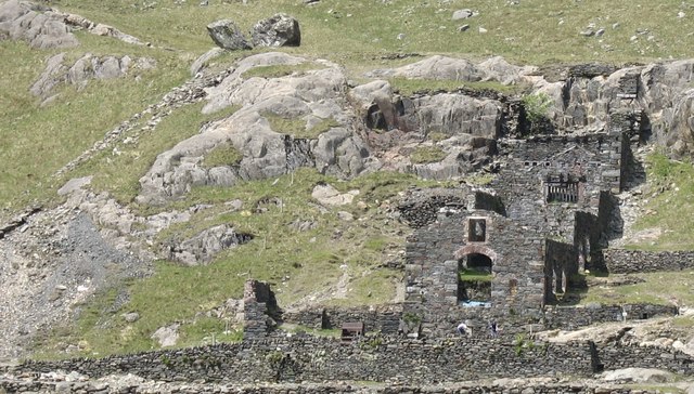
Incline built to serve now abandoned nearby workings with the Britannia Crushing Mill
The workings accessed by means of a level are located west of the mill.
 Map © Crown Copyright")
TIP: Click the map for more Large scale mapping
- Grid Square
- SH6254, 149 images (more nearby 🔍)
- Photographer
- Eric Jones (more nearby)
- Date Taken
- Tuesday, 6 June, 2006 (more nearby)
- Submitted
- Monday, 1 June, 2020
- Subject Location
-
OSGB36:
 SH 6283 5448 [10m precision]
WGS84: 53:4.1936N 4:2.9260W - Camera Location
-
OSGB36: SH 6328 5437
- View Direction
- West-northwest (about 292 degrees)