SZ0896 : Northbourne: Heads Lane
taken 4 years ago, near to Ensbury, Bournemouth, Christchurch & Poole, England
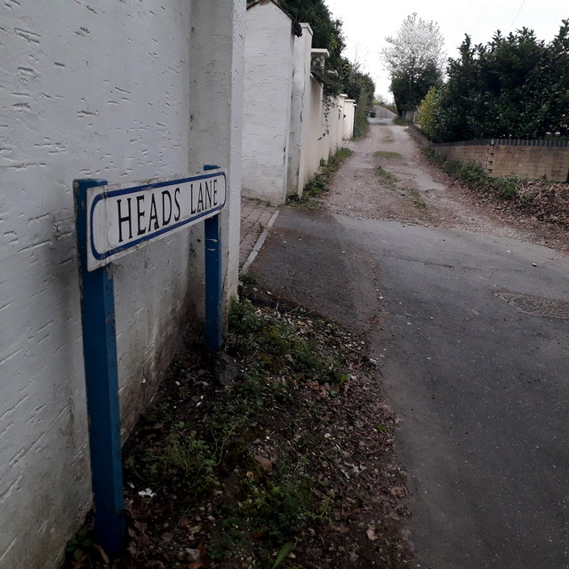
It is also a public right of way, number O20 this end and O21 further along: see SZ0896 : Northbourne: eastern end of Heads Lane for a wider view from just behind us, including more discussion and links to further pictures on the route ahead.
The sign is of a design that became prevalent in Bournemouth around 1990 and was in use for most of that decade, but a rarer single-line variant (see for example SZ0695 : West Howe: Gort Road for the standard version, with room for two lines of text although not always used). The blue border has faded and the white surface started unpeeling on many of them, but this one is in pretty good condition, perhaps because it faces north and doesn't get much direct sunlight.
This is photo no.184 of a series of 453 in my coronavirus lockdown walking project:
See Link for the complete set of photos.
In response to the global coronavirus pandemic, on 23 March 2020 the government announced a lockdown which effectively confined people to their homes, apart from essential journeys which included vital shopping, to help vulnerable people, and one period of exercise per day.
There was speculation about whether driving to a place of exercise, such as a beauty spot, was acceptable and guidelines were quickly made, that exercise should take place locally and direct from home.
So I drew a 2km radius around my home on a map and set out to walk along, across or past every named street and footpath within this circle.
I found that there are 451 such roads/paths, not including roads whose postal address is part of another road already included (such as some Courts, Terraces and Mews).
I undertook to take a photo of a sign for each one, mainly with some context of the road itself. They can all be viewed, along with my 2km map, here: Link
 Map © Crown Copyright")
- Grid Square
- SZ0896, 119 images (more nearby 🔍)
- Photographer
- Chris Downer (more nearby)
- Date Taken
- Monday, 13 April, 2020 (more nearby)
- Submitted
- Friday, 5 June, 2020
- Subject Location
-
OSGB36:
 SZ 0848 9605 [10m precision]
WGS84: 50:45.8388N 1:52.8677W - Camera Location
-
OSGB36: SZ 0852 9604
- View Direction
- WEST (about 270 degrees)