2020
NH6994 : Forestry Track above Achormlarie, Sutherland
taken 4 years ago, near to Achvaich, Highland, Scotland
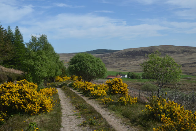
Forestry Track above Achormlarie, Sutherland
This track runs several miles from Achormlarie to Loch Buidhe, Scottish Highlands. The track is in reasonable condition for most of its length and should be passable by mountain bike or trail bike.
 Map © Crown Copyright")
TIP: Click the map for more Large scale mapping
- Grid Square
- NH6994, 11 images (more nearby 🔍)
- Photographer
- Andrew Tryon (more nearby)
- Date Taken
- Saturday, 30 May, 2020 (more nearby)
- Submitted
- Saturday, 6 June, 2020
- Subject Location
-
OSGB36:
 NH 6948 9482 [10m precision]
WGS84: 57:55.4143N 4:12.3163W - Camera Location
-
OSGB36: NH 69461 94840
- View Direction
- Southeast (about 135 degrees)