2020
SE0410 : Path across Butterley reservoir dam
taken 4 years ago, near to Marsden, Kirklees, England
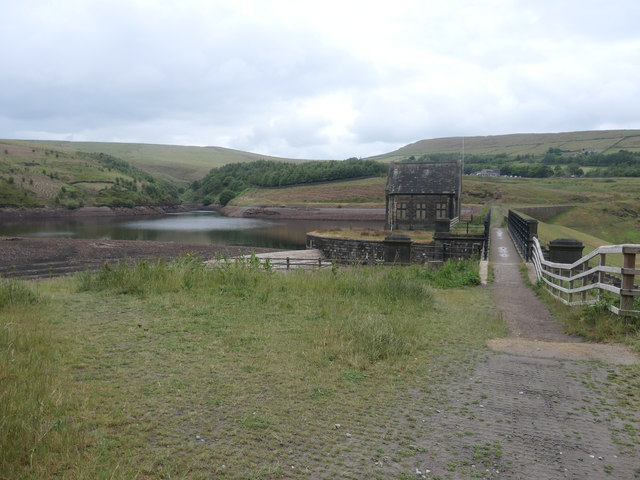
Path across Butterley reservoir dam
This is the lowest of four reservoirs in the Wessenden valley. It was opened in 1906 by Huddersfield Corporation.
 Map © Crown Copyright")
TIP: Click the map for more Large scale mapping
- Grid Square
- SE0410, 69 images (more nearby 🔍)
- Photographer
- Christine Johnstone (more nearby)
- Date Taken
- Wednesday, 10 June, 2020 (more nearby)
- Submitted
- Friday, 12 June, 2020
- Subject Location
-
OSGB36:
 SE 0481 1057 [10m precision]
WGS84: 53:35.5012N 1:55.7283W - Camera Location
-
OSGB36: SE 0487 1058
- View Direction
- WEST (about 270 degrees)