2020
SE1224 : Sign for Brighouse Footpath 33, Link 3, Hove Edge
taken 4 years ago, near to Hipperholme, Calderdale, England
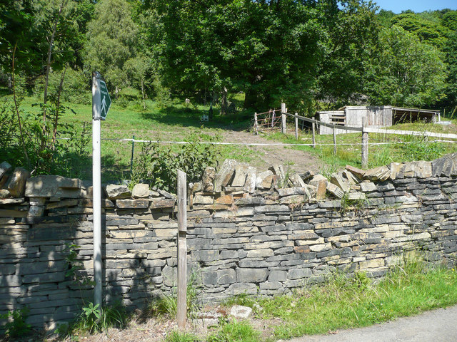
Sign for Brighouse Footpath 33, Link 3, Hove Edge
This path is not 'Granny friendly'. It goes through a gate to the right and up the field past the stable and into Sutcliffe Wood through a stile at the top. Then there is an awkward scramble up the steep hillside to the main path that runs along the top of the wood.
 Map © Crown Copyright")
TIP: Click the map for more Large scale mapping
- Grid Square
- SE1224, 129 images (more nearby 🔍)
- Photographer
- Humphrey Bolton (more nearby)
- Date Taken
- Thursday, 25 June, 2020 (more nearby)
- Submitted
- Saturday, 27 June, 2020
- Subject Location
-
OSGB36:
 SE 1237 2470 [10m precision]
WGS84: 53:43.1140N 1:48.8420W - Camera Location
-
OSGB36: SE 1237 2470
- View Direction
- East-northeast (about 67 degrees)