2020
SE1224 : Path across former Southedge Quarry, Hove Edge
taken 4 years ago, near to Hipperholme, Calderdale, England
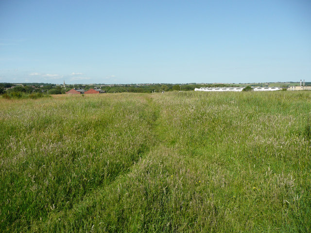
Path across former Southedge Quarry, Hove Edge
Southedge and Stubbins quarries covered a large area between Halifax Road and Sutcliffe Wood; stone was also mined. After these closed the land was used for waste disposal and the site was then capped and turned into a vast hay field. The part of the site next to Halifax Road is likely to be developed for housing before long, whereas the western part next to the wood is to be held in reserve. The path is heading towards Halifax Road, but is not one of the rights-of-way that cross the site.
 Map © Crown Copyright")
TIP: Click the map for more Large scale mapping
- Grid Square
- SE1224, 129 images (more nearby 🔍)
- Photographer
- Humphrey Bolton (more nearby)
- Date Taken
- Tuesday, 23 June, 2020 (more nearby)
- Submitted
- Saturday, 27 June, 2020
- Subject Location
-
OSGB36:
 SE 1237 2491 [10m precision]
WGS84: 53:43.2273N 1:48.8415W - Camera Location
-
OSGB36: SE 1236 2490
- View Direction
- Northeast (about 45 degrees)