2020
NT2561 : Wester Auchendinny Bridge
taken 4 years ago, near to Auchendinny, Midlothian, Scotland
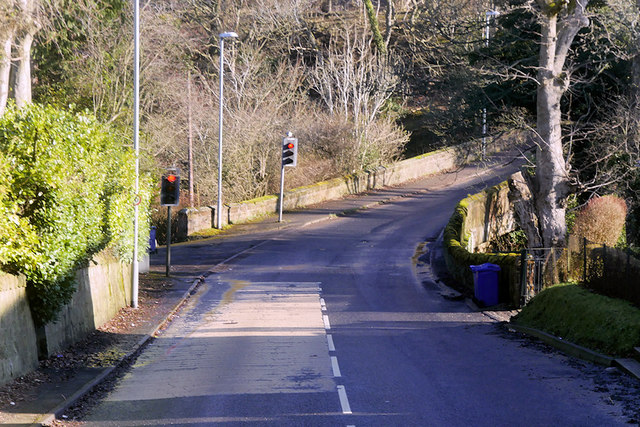
Wester Auchendinny Bridge
The B7026 is a link road running for 3 miles between Howgate and Auchendinny, passing to the east of the town of Penicuik. This is the first of two bridges in the village of Auchendinny This one carries the road over the Glencorse Burn, the other (easter Auchendinny Bridge) crosses the River North Esk. Both are narrow enough to require traffic lights to control traffic flow
 Map © Crown Copyright")
TIP: Click the map for more Large scale mapping
- Grid Square
- NT2561, 66 images (more nearby 🔍)
- Photographer
- David Dixon (more nearby)
- Date Taken
- Tuesday, 3 March, 2020 (more nearby)
- Submitted
- Saturday, 4 July, 2020
- Subject Location
-
OSGB36:
 NT 251 617 [100m precision]
WGS84: 55:50.5611N 3:11.8018W - Camera Location
-
OSGB36: NT 250 616
- View Direction
- Northeast (about 45 degrees)