2006
SH5961 : View past Twll y Mwg Mill towards the Drum House of the A7 incline
taken 17 years ago, near to Dinorwig, Gwynedd, Wales
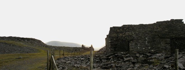
View past Twll y Mwg Mill towards the Drum House of the A7 incline
This was the highest mill in the quarry, situated on the north-western side of the quarry it dealt with slate from the 7 top galleries. It held 16 sawing tables but no dressing machines, all shaping being done by hand. It was opened in March 1925. SH5961 : Close-up of Sied Twllymwg with the A8 incline in the background
 Map © Crown Copyright")
TIP: Click the map for more Large scale mapping
- Grid Square
- SH5961, 138 images (more nearby 🔍)
- Photographer
- Eric Jones (more nearby)
- Date Taken
- Saturday, 9 December, 2006 (more nearby)
- Submitted
- Monday, 6 July, 2020
- Subject Location
-
OSGB36:
 SH 5969 6122 [10m precision]
WGS84: 53:7.7773N 4:5.9126W - Camera Location
-
OSGB36: SH 5971 6125
- View Direction
- Southwest (about 225 degrees)