2020
SE1125 : Spring at Cold Well Hill, Southowram
taken 4 years ago, near to Hipperholme, Calderdale, England
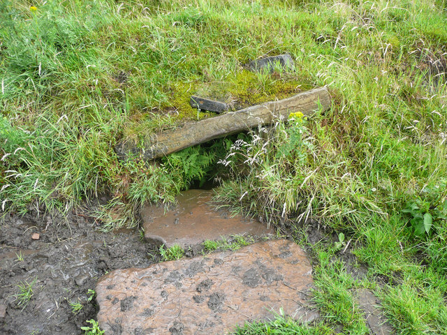
Spring at Cold Well Hill, Southowram
This is presumably the 'Cold Well' of the name of the farm that it supplied with water. I didn't dabble my fingers in the water to check. There should be another spring adjacent, but I didn't see it. The farm is shown on the 1930 1:2500, but the access was only by the narrow Pump Lane and Little Lane, The latter has disappeared although still shown on maps.
 Map © Crown Copyright")
TIP: Click the map for more Large scale mapping
- Grid Square
- SE1125, 184 images (more nearby 🔍)
- Photographer
- Humphrey Bolton (more nearby)
- Date Taken
- Sunday, 5 July, 2020 (more nearby)
- Submitted
- Thursday, 9 July, 2020
- Subject Location
-
OSGB36:
 SE 1116 2532 [10m precision]
WGS84: 53:43.4500N 1:49.9408W - Camera Location
-
OSGB36: SE 1116 2532
- View Direction
- SOUTH (about 180 degrees)