2020
TA1822 : Marshland Vista
taken 4 years ago, 3 km from Paull, East Riding of Yorkshire, England
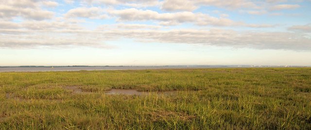
Marshland Vista
This is the view westwards from the eastern side of the square. I've tried on several occasions to get to this square! The marshland is riddled with dikes that are too wide to cross. None of the OS maps show the terrain here so the dikes are not shown. It looks as though this land isn't taken in by the tide too often as land vegetation thrives here. I had to work out my route to this point using the Google Earth photos (the OS ones don't have the resolution required). Nevertheless, minor (50cm wide or less) dikes were invariably covered in vegetation making the terrain difficult to traverse...... I won't be going back!
 Map © Crown Copyright")
TIP: Click the map for more Large scale mapping
- Grid Square
- TA1822, 4 images (more nearby 🔍)
- Photographer
- Andy Beecroft (more nearby)
- Date Taken
- Sunday, 12 July, 2020 (more nearby)
- Submitted
- Sunday, 12 July, 2020
- Subject Location
-
OSGB36:
 TA 1833 2294 [10m precision]
WGS84: 53:41.3709N 0:12.5731W - Camera Location
-
OSGB36: TA 1899 2273
- View Direction
- West-northwest (about 292 degrees)