2020
NT9513 : Looking down the valley of the Shank Burn
taken 4 years ago, 3 km from Linhope, Northumberland, England
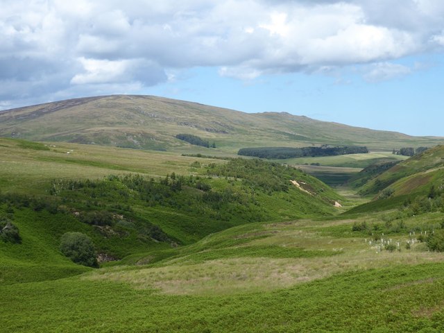
Looking down the valley of the Shank Burn
Dunmoor Hill is prominent on the left with Cunyan Crags to the right.
 Map © Crown Copyright")
TIP: Click the map for more Large scale mapping
- Grid Square
- NT9513, 16 images (more nearby 🔍)
- Photographer
- Russel Wills (more nearby)
- Date Taken
- Tuesday, 21 July, 2020 (more nearby)
- Submitted
- Wednesday, 22 July, 2020
- Subject Location
-
OSGB36:
 NT 9597 1368 [10m precision]
WGS84: 55:25.0212N 2:3.9127W - Camera Location
-
OSGB36: NT 95972 13680
- View Direction
- North-northeast (about 22 degrees)