2017
SJ9689 : Lock 4, Marple Flight
taken 7 years ago, near to Compstall, Stockport, England
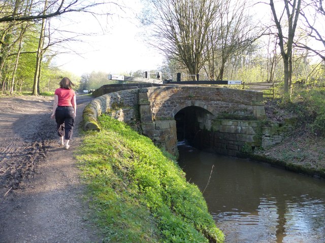
Lock 4, Marple Flight
Grade II listed lock on the Peak Forest Canal. Link
Peak Forest Canal
The Peak Forest Canal runs for 15 miles between Ashton under Lyne and Whaley Bridge.
It was built to link the Ashton Canal with the tramways that brought limestone from the Peak District quarries.
The Lower Peak Forest Canal forms part of the "Cheshire Ring".
Link
Link
 Map © Crown Copyright")
TIP: Click the map for more Large scale mapping
- Grid Square
- SJ9689, 258 images (more nearby 🔍)
- Photographer
- Dave Dunford (more nearby)
- Date Taken
- Saturday, 8 April, 2017 (more nearby)
- Submitted
- Sunday, 26 July, 2020
- Subject Location
-
OSGB36:
 SJ 9607 8973 [10m precision]
WGS84: 53:24.2625N 2:3.6346W - Camera Location
-
OSGB36: SJ 9605 8977
- View Direction
- South-southeast (about 157 degrees)