2014
NS6635 : Glengavel Reservoir Spillway
taken 10 years ago, 4 km SSE of Drumclog, South Lanarkshire, Scotland
This is 1 of 2 images, with title Glengavel Reservoir Spillway in this square
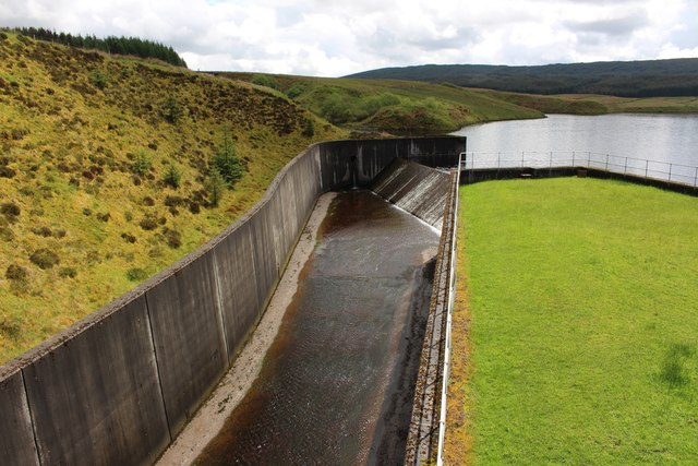
Glengavel Reservoir Spillway
 Map © Crown Copyright")
TIP: Click the map for more Large scale mapping
- Grid Square
- NS6635, 20 images (more nearby 🔍)
- Photographer
- Graeme Yuill (more nearby)
- Date Taken
- Monday, 26 May, 2014 (more nearby)
- Submitted
- Sunday, 26 July, 2020
- Subject Location
-
OSGB36:
 NS 6640 3501 [10m precision]
WGS84: 55:35.4203N 4:7.2861W - Camera Location
-
OSGB36: NS 6638 3503
- View Direction
- South-southeast (about 157 degrees)