2017
SD7469 : Benchmark on barn at junction of B6480 and Cross Haw Lane
taken 7 years ago, near to Clapham, North Yorkshire, England
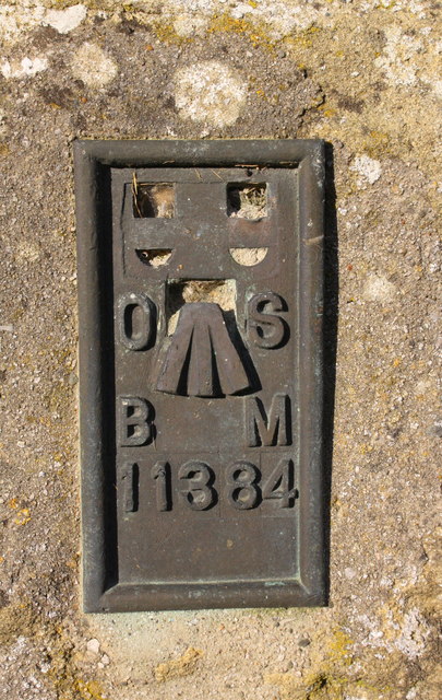
Benchmark on barn at junction of B6480 and Cross Haw Lane
Ordnance Survey flush bracket (serial number 11384) benchmark described on the Bench Mark Database at Link
 Map © Crown Copyright")
TIP: Click the map for more Large scale mapping
- Grid Square
- SD7469, 316 images (more nearby 🔍)
- Photographer
- Roger Templeman (more nearby)
- Date Taken
- Thursday, 5 October, 2017 (more nearby)
- Submitted
- Friday, 31 July, 2020
- Subject Location
-
OSGB36:
 SD 7437 6920 [10m precision]
WGS84: 54:7.0814N 2:23.6158W - Camera Location
-
OSGB36: SD 7437 6920
- View Direction
- North-northeast (about 22 degrees)