2020
TL1507 : Gainsborough Avenue
taken 4 years ago, near to St Albans, Hertfordshire, England
This is 1 of 3 images, with title Gainsborough Avenue in this square
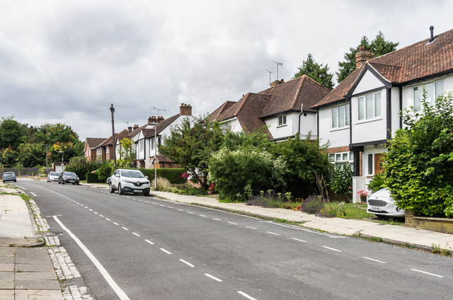
Gainsborough Avenue
Cul-de-sac off Clarence Road, marked without development on the 1924 1:2,500 map (when it was shown as Wormleighton Road), but not seeing any building until the northern side (seen here) was developed in the 1930s. The southern side was undeveloped until after the Second World War, with some plots not built on until the 1960s. It ends at the railway (seen in the left background), although unlike its neighbours York Road and Jennings Road, it has no footbridge linking it to Lemsford Road.
 Map © Crown Copyright")
TIP: Click the map for more Large scale mapping
- Grid Square
- TL1507, 420 images (more nearby 🔍)
- Photographer
- Ian Capper (more nearby)
- Date Taken
- Saturday, 25 July, 2020 (more nearby)
- Submitted
- Wednesday, 5 August, 2020
- Subject Location
-
OSGB36:
 TL 157 077 [100m precision]
WGS84: 51:45.3683N 0:19.4311W - Camera Location
-
OSGB36: TL 158 077
- View Direction
- West-northwest (about 292 degrees)