2020
TQ3728 : Caske Field/Middle Mill Field/Mill Field
taken 4 years ago, near to Horsted Keynes, West Sussex, England
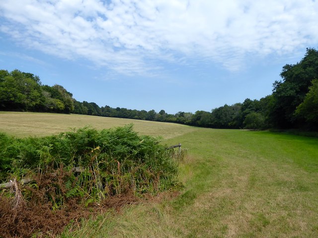
Caske Field/Middle Mill Field/Mill Field
The name of the fields according to Horsted Keynes' 1842 tithe map that have been merged to form a larger unit. Caske Field is in the foreground adjacent to Cinder Hill Lane whilst Mill Field is at the far end next to Cinder Banks. Middle Mill Field is in the middle of the two. Alderly Platt is the wood on the right.
 Map © Crown Copyright")
TIP: Click the map for more Large scale mapping
- Grid Square
- TQ3728, 85 images (more nearby 🔍)
- Photographer
- Simon Carey (more nearby)
- Date Taken
- Sunday, 9 August, 2020 (more nearby)
- Submitted
- Tuesday, 11 August, 2020
- Subject Location
-
OSGB36:
 TQ 3775 2858 [10m precision]
WGS84: 51:2.4043N 0:2.1936W - Camera Location
-
OSGB36: TQ 3769 2845
- View Direction
- North-northeast (about 22 degrees)