2020
ST2694 : Ordnance Survey Cut Mark
taken 4 years ago, near to Henllys, Torfaen/Tor-Faen, Wales
This is 1 of 5 images, with title Ordnance Survey Cut Mark in this square
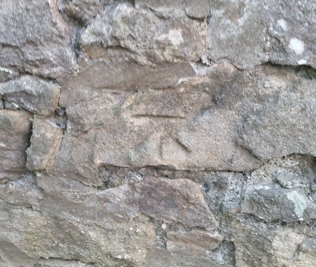
Ordnance Survey Cut Mark
This OS cut mark can be found on the SW face of Mount Pleasant Chapel. It marks a point 229.819m above mean sea level.
 Map © Crown Copyright")
TIP: Click the map for more Large scale mapping
- Grid Square
- ST2694, 74 images (more nearby 🔍)
- Photographer
- Adrian Dust (more nearby)
- Date Taken
- Monday, 17 August, 2020 (more nearby)
- Submitted
- Tuesday, 18 August, 2020
- Subject Location
-
OSGB36:
 ST 2640 9444 [10m precision]
WGS84: 51:38.6354N 3:3.9035W - Camera Location
-
OSGB36: ST 2640 9444
- View Direction
- North-northeast (about 22 degrees)