2020
SX5646 : Revelstoke Park
taken 4 years ago, near to Noss Mayo, Devon, England
This is 1 of 2 images, with title Revelstoke Park in this square
Revelstoke Park
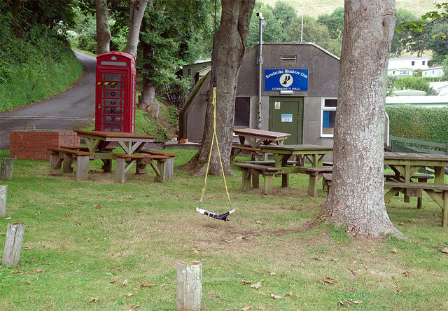
Revelstoke Park is a large independently operated fixed caravan park. These developments divide opinion: on the one hand they can be considered an eyesore spoiling some of Britain's most attractive coastal locations, on the other they provide many families with relatively cheap seaside holidays. Revelstoke is laid out with rather more thought given to the visual impact than many others with the caravans well spaced out among established trees and gardens rather than in regimented rows. At its heart is this members' club - the community hall - which appears to occupy an old nissen hut and provides plenty of outdoor seating and even a rope swing for children. The K6 telephone box is no longer in use as such but is now a book exchange (although it is taped off in this view, presumably as a Covid-19 precaution). The lane on the left leads up to Stoke Cross and is the only vehicular access to the site.
 Map © Crown Copyright")
TIP: Click the map for more Large scale mapping
- Grid Square
- SX5646, 91 images (more nearby 🔍)
- Photographer
- Stephen McKay (more nearby)
- Date Taken
- Sunday, 16 August, 2020 (more nearby)
- Submitted
- Friday, 21 August, 2020
- Subject Location
-
OSGB36:
 SX 5639 4648 [10m precision]
WGS84: 50:18.0445N 4:1.0694W - Camera Location
-
OSGB36: SX 5639 4647
- View Direction
- NORTH (about 0 degrees)