2020
NJ0331 : Mid Lynmore Wood
taken 4 years ago, near to Glaschoil, Highland, Scotland
This is 1 of 3 images, with title Mid Lynmore Wood in this square
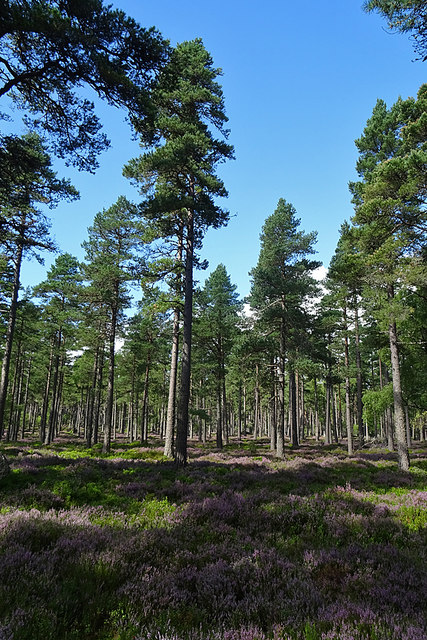
Mid Lynmore Wood
Scots Pines with an understorey of heather, blaeberries and cowberries.
The Dava Way
The Dava Way is a 38 kilometre (24 mile) path linking Grantown-on-Spey with Forres. For most of the way it uses the trackbed of the Inverness and Perth Junction Railway, which was closed in 1965.
It's a long but very easy walk on firm ground with no steep climbs, and most of it is on moorland with open views. There are numerous points where it is close to the A940 or A939, so it can easily be done in several shorter sections rather than the full 24 miles having to be done in a single expedition.
It's also well maintained, being looked after by the volunteers of the Dava Way Association. See Linkfor information about the Association.
 Map © Crown Copyright")
TIP: Click the map for more Large scale mapping
- Grid Square
- NJ0331, 26 images (more nearby 🔍)
- Photographer
- Anne Burgess (more nearby)
- Date Taken
- Wednesday, 19 August, 2020 (more nearby)
- Submitted
- Friday, 21 August, 2020
- Subject Location
-
OSGB36:
 NJ 0343 3175 [10m precision]
WGS84: 57:21.9564N 3:36.4298W - Camera Location
-
OSGB36: NJ 0348 3170
- View Direction
- Northwest (about 315 degrees)