J3731 : Flooded inter-riverine parkland between the Tullybranigan and Shimna rivers
taken 4 years ago, near to Newcastle, Co Down, Northern Ireland
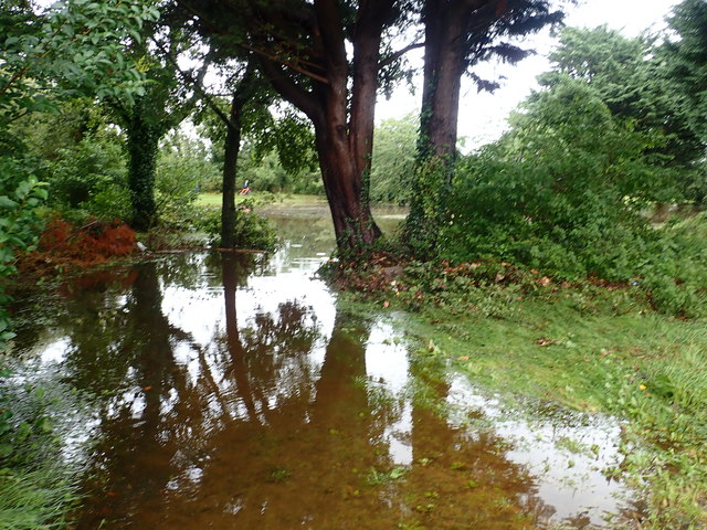
Flooded inter-riverine parkland between the Tullybranigan and Shimna rivers
Both rivers flooded parts of Islands Park during Storm Francis with the Shimna also flooding low lying residential parts of the town.
Storm Francis
Moving in rapidly from the Atlantic overnight 24th-25th of August, 2020, the deepening Storm Francis brought intense rain to the North of Ireland. This resulted in flash flooding in many parts of the province, the worst incidence being in the coastal resort of Newcastle at the foot of the High Mournes in Co Down. Here, the Shimna River burst its banks and flooded low lying areas of the town. Over 100 homes were flooded and a major rescue operation was mounted by the PSNI, the NIFRS and HM Coastguard. A similar event took place in August 2008..
![Creative Commons Licence [Some Rights Reserved]](https://s1.geograph.org.uk/img/somerights20.gif)
|
· Find out How to reuse this image ·
Share:
|
|||||
| Start a discussion on J3731 | Suggest an update to this image | Contact the contributor | |||
Loading map... (JavaScript required)
- Grid Square
- J3731, 1847 images (more nearby
 )
)
- Photographer
- Eric Jones (find more nearby)
- Date Taken
- Tuesday, 25 August, 2020 (more nearby)
- Submitted
- Thursday, 27 August, 2020
- Geographical Context
- Subject Location
-
Irish:
 J 373 312 [100m precision]
WGS84: 54:12.7028N 5:53.7638W - Camera Location
-
Irish: J 372 312
- View Direction
- East-northeast (about 67 degrees)
This page has been viewed about 44 times.
View this location:
KML (Google Earth) ·
Google Maps ·
Bing Maps ·
Geograph Coverage Map ·
More Links for this image
·
Bing Maps ·
Geograph Coverage Map ·
More Links for this image