SP3097 : Atherstone Top Lock, Coventry Canal
taken 4 years ago, near to Atherstone, Warwickshire, England
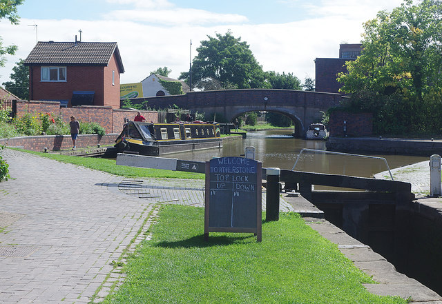
The Coventry Canal enabling Act was passed in 1768 to connect Coventry with the Trent and Mersey Canal. Coventry to Bedworth was completed in 1769 for the revenue earning coal traffic but by 1771 when the canal reached Atherstone all authorised capital had been spent and James Brindley the first engineer was sacked. The canal didn't reach Fazeley, 12 miles short of its intended terminus, until 1790. The Birmingham and Fazeley Canal continued along the proposed line of the Coventry Canal to Whittington brook. The Trent and Mersey Canal (Grand Trunk Canal Co.) completed the section to Fradley and later sold it to the Coventry Canal which explains the disjointed section. It was one of the most profitable canals ever built in Britain paying dividends up to 1947. Coventry basin to Fradley junction is 38 miles with 13 locks.
 Map © Crown Copyright")
- Grid Square
- SP3097, 244 images (more nearby 🔍)
- Photographer
- Stephen McKay (more nearby)
- Date Taken
- Wednesday, 9 September, 2020 (more nearby)
- Submitted
- Thursday, 10 September, 2020
- Subject Location
-
OSGB36:
 SP 3060 9751 [10m precision]
WGS84: 52:34.4732N 1:32.9943W - Camera Location
-
OSGB36: SP 3057 9753
- View Direction
- Southeast (about 135 degrees)