2020
NT6466 : Ling Rig and Spartleton Edge
taken 4 years ago, near to Ling Rig [other Features], East Lothian, Great Britain
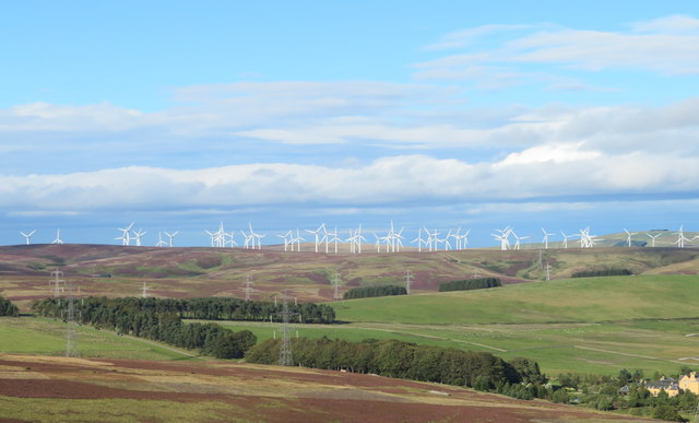
Ling Rig and Spartleton Edge
With Crystal Rig Wind Farm on Dunbar Common behind.
 Map © Crown Copyright")
TIP: Click the map for more Large scale mapping
- Grid Square
- NT6466, 14 images (more nearby 🔍)
- Photographer
- M J Richardson (more nearby)
- Date Taken
- Tuesday, 8 September, 2020 (more nearby)
- Submitted
- Thursday, 10 September, 2020
- Subject Location
-
OSGB36:
 NT 644 665 [100m precision]
WGS84: 55:53.4186N 2:34.2454W - Camera Location
-
OSGB36: NT 616 631
- View Direction
- Northeast (about 45 degrees)