2020
SX4853 : Cattewater
taken 4 years ago, near to Turnchapel, Plymouth, England
This is 1 of 6 images, with title Cattewater in this square
Cattewater
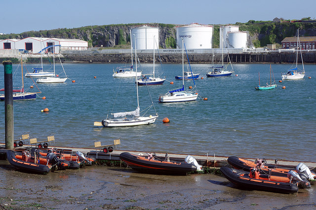
Several RIBs are sitting on the mud close to low tide; further out a number of yachts are tied up in the open water. Greenenergy's oil storage tanks can be seen on the other side.
Cattewater :: SX4953
The Cattewater is that stretch of water where the mouth of the River Plym merges with Plymouth Sound, just to the east of Sutton Pool. It is around this Pool that the manor of Sutton started, which grew to form the present day city. On the northern shore of this confluence of waters there was a rock outcrop, which it was claimed, had the appearance of a cat. This gave its name to this stretch of water and eventually the name of Cattedown to the adjoining wharves and commercial area. Apart from an occasional small oil tanker the area is now used mostly by fishing trawlers, yachts, and smaller pleasure craft.
 Map © Crown Copyright")
TIP: Click the map for more Large scale mapping
- Grid Square
- SX4853, 1004 images (more nearby 🔍)
- Photographer
- Stephen McKay (more nearby)
- Date Taken
- Thursday, 17 September, 2020 (more nearby)
- Submitted
- Saturday, 19 September, 2020
- Subject Location
-
OSGB36:
 SX 4882 5333 [10m precision]
WGS84: 50:21.6246N 4:7.6073W - Camera Location
-
OSGB36: SX 4879 5329
- View Direction
- Northeast (about 45 degrees)