2020
TQ3531 : Kiln Field/Square Seven Acres
taken 4 years ago, near to Highbrook, West Sussex, England
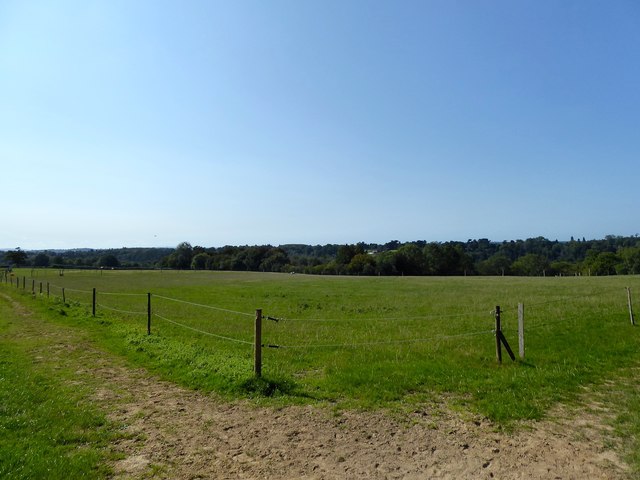
Kiln Field/Square Seven Acres
The name of the fields according to West Hoathly's 1841 tithe map that have been merged to form a larger unit. Kiln Field was in the foreground to the immediate south of the former Hook Quarry whilst Square Seven Acres is beyond. Both are bounded by Hook Lane to the east and Barnland Wood to the west.
 Map © Crown Copyright")
TIP: Click the map for more Large scale mapping
- Grid Square
- TQ3531, 21 images (more nearby 🔍)
- Photographer
- Simon Carey (more nearby)
- Date Taken
- Sunday, 13 September, 2020 (more nearby)
- Submitted
- Sunday, 20 September, 2020
- Subject Location
-
OSGB36:
 TQ 3543 3115 [10m precision]
WGS84: 51:3.8232N 0:4.1202W - Camera Location
-
OSGB36: TQ 3556 3124
- View Direction
- Southwest (about 225 degrees)