2020
NT5118 : Ruins at Alton
taken 4 years ago, near to Clarilaw, Scottish Borders, Scotland
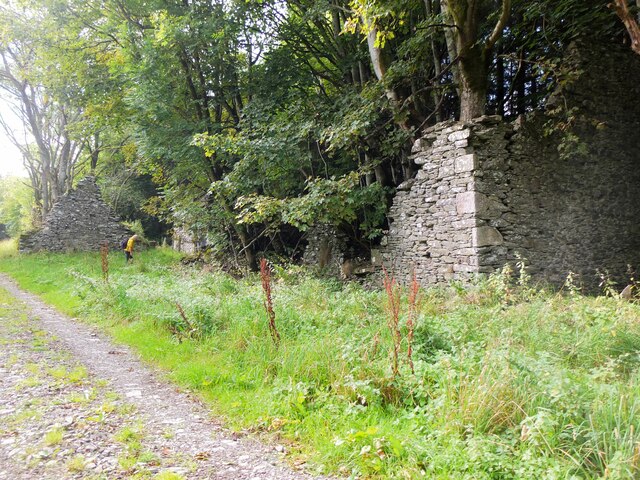
Ruins at Alton
Remains of houses or barns from some time ago, judging by the size of the trees that have taken over.
 Map © Crown Copyright")
TIP: Click the map for more Large scale mapping
- Grid Square
- NT5118, 6 images (more nearby 🔍)
- Photographer
- Jim Barton (more nearby)
- Date Taken
- Friday, 2 October, 2020 (more nearby)
- Submitted
- Saturday, 3 October, 2020
- Subject Location
-
OSGB36:
 NT 5134 1887 [10m precision]
WGS84: 55:27.6745N 2:46.2647W - Camera Location
-
OSGB36: NT 5136 1887
- View Direction
- WEST (about 270 degrees)