2020
SD4575 : Below the Silverdale cliffs
taken 4 years ago, near to Silverdale, Lancashire, England
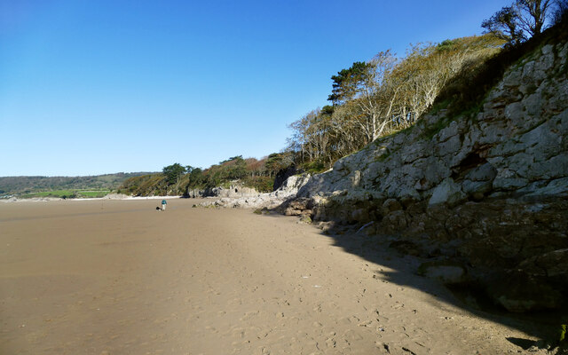
Below the Silverdale cliffs
Despite being close to high tide, we aren't at springs, so the beach remains fit and safe for walking, allowing inspection of the line of low cliffs in the Limestone. This area is covered by BGS sheet 49, which was last surveyed in the nineteenth century, isn't in print and isn't on the BGS geological map viewer online, so it takes a bit of effort to find out what is going on. The best source available online seems to be "The Geological Story of Arnside & Silverdale Area of Outstanding Natural Beauty" dated 2019 and published by Cuesta Consulting Ltd. without the benefit of an ISBN number. This contains geological maps, which would have been a lot more useful with the National Grid on them, but do at least enable one to determine that the immediate foreground is Urswick Limestone (Asbian) but the cliffs in the middle distance are the Park Limestone which is older (Holkerian), but faulted upwards pretty much along the line of the coast. There is a very obvious cave entrance in the Park Limestone, which always attracts the interests of visiting cavers, being such an attractive-looking phreatic tube just inviting exploration. It soon proves disappointing as it is quite short, and is clearly used as a toilet being the only convenient hiding place in the vicinity.
 Map © Crown Copyright")
TIP: Click the map for more Large scale mapping
- Grid Square
- SD4575, 122 images (more nearby 🔍)
- Photographer
- Andy Waddington (more nearby)
- Date Taken
- Tuesday, 29 September, 2020 (more nearby)
- Submitted
- Monday, 5 October, 2020
- Subject Location
-
OSGB36:
 SD 4564 7530 [10m precision]
WGS84: 54:10.2360N 2:50.0512W - Camera Location
-
OSGB36: SD 4566 7523
- View Direction
- North-northwest (about 337 degrees)